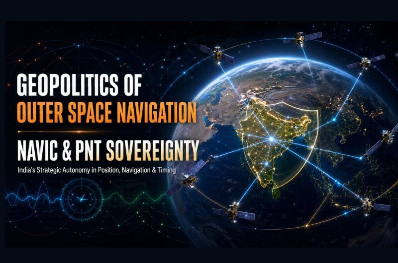
Geopolitics of Outer Space Navigation: NavIC & PNT Sovereignty
1. Navigation with Indian Constellation, or NavIC, is India’s autonomous regional satellite navigation system. It provides Position, Navigation and Timing services over India and about 1,500 km beyond its borders.
2. NavIC strengthens India’s technological and strategic autonomy because it reduces dependence on foreign satellite-navigation systems for civilian, commercial and military needs.
3. The Kargil conflict of 1999 exposed India’s dependence on foreign navigation infrastructure when the United States did not provide the requested high-precision GPS data for the conflict area.
4. Position, Navigation and Timing data is essential for power grids, telecommunication networks, financial timestamping, transport systems, disaster response and precision-guided military operations.
5. Dependence on foreign Global Navigation Satellite Systems such as GPS, GLONASS, Galileo and BeiDou can create risks of signal denial, degradation, cyber spoofing or restricted access during geopolitical tensions.
6. NavIC is an important element of Atmanirbhar Bharat in the space sector because India owns and controls this national navigation asset.
7. Unlike the United States GPS, which mainly uses Medium Earth Orbit satellites, NavIC uses a combination of Geostationary Orbit and Inclined Geosynchronous Orbit satellites.
8. The use of Geostationary and Inclined Geosynchronous satellites provides continuous high-elevation visibility over the Indian subcontinent and surrounding region.
9. NavIC transmits navigation signals in the L5 and S-bands. The S-band can support signal reception in dense urban areas and under tree cover, while newer NVS-series satellites also support the L1 band.
10. NavIC provides two main services: the Standard Positioning Service, which is open for civilian use in mapping, transport and mobile devices, and the encrypted Restricted Service for authorised strategic users.
11. China is expanding the use of its BeiDou navigation system in South Asian countries such as Nepal, Sri Lanka and Bangladesh. Satellite-navigation cooperation has therefore become an important tool of regional technological influence.
12. India can use NavIC-based services and regional cooperation with friendly neighbouring countries to strengthen digital connectivity and reduce regional dependence on competing navigation systems.
13. Satellite-navigation systems are dual-use assets because they support both civilian activities and military operations. They are exposed to risks from anti-satellite capabilities, electronic jamming, cyber-attacks and signal spoofing.
14. A sovereign regional constellation can provide India with an independent navigation capability for military Command, Control, Communications, Computers, Intelligence, Surveillance and Reconnaissance systems, although it must still be protected from jamming and cyber threats.
15. Precise navigation depends on highly accurate atomic clocks. Early NavIC satellites faced failures of imported Rubidium atomic clocks, but NVS-series satellites include indigenously developed atomic clocks. Major challenges remain in expanding commercial use in vehicle trackers and mobile chipsets, increasing the domestic user base, and developing a wider global reach through a possible NavIC 2.0 expansion using Medium Earth Orbit satellites.
Must Know Terms :
1.Position, Navigation and Timing (PNT)
PNT services provide accurate location, route guidance and precise timing. They are essential for transport, telecom networks, power grids, banking systems and military operations.
2. NavIC
Navigation with Indian Constellation is India’s autonomous regional satellite-navigation system. It covers India and about 1,500 km beyond its borders.
3. Geostationary Orbit (GEO)
A satellite in GEO appears fixed over one point on the Equator because it moves at the same speed as Earth’s rotation. It enables continuous coverage of a particular region.
4. Inclined Geosynchronous Orbit (GSO)
A GSO satellite takes the same time as Earth’s rotation but follows an inclined path. Along with GEO satellites, it gives NavIC strong visibility over India.
5. Standard Positioning Service (SPS)
SPS is NavIC’s open service for civilian users. It supports mapping, transport, mobile devices, disaster management and other public applications.
6. Restricted Service (RS)
RS is NavIC’s encrypted navigation service for authorised strategic users. It supports secure military and national-security operations.
MCQ :
1. With reference to NavIC, consider the following statements:
1. It is India’s autonomous regional satellite-navigation system.
2. It provides Position, Navigation and Timing services.
3. Its service area includes India and about 1,500 km beyond its borders.
Which of the statements given above are correct?
(a) 1 and 2 only
(b) 2 and 3 only
(c) 1 and 3 only
(d) 1, 2 and 3
2. The development of an indigenous navigation system for India received major strategic importance after:
(a) The Pokhran nuclear tests
(b) The Kargil conflict of 1999
(c) The launch of Chandrayaan-1
(d) The establishment of ISRO
3. Which one of the following is not a major application of Position, Navigation and Timing services?
(a) Financial timestamping
(b) Telecommunication networks
(c) Precision-guided military operations
(d) Weather modification
4. Dependence on foreign Global Navigation Satellite Systems may expose a country to:
1. Signal denial
2. Signal degradation
3. Cyber spoofing
4. Restricted access during geopolitical tensions
Select the correct answer using the code given below:
(a) 1 and 2 only
(b) 3 and 4 only
(c) 1, 2 and 3 only
(d) 1, 2, 3 and 4
5. Which one of the following correctly explains NavIC’s contribution to Atmanirbhar Bharat in the space sector?
(a) It gives India ownership and control over a national navigation asset.
(b) It eliminates the need for all foreign satellite services.
(c) It is designed only for military users.
(d) It provides global coverage identical to GPS.
6. NavIC uses which of the following orbital configurations?
(a) Only Low Earth Orbit satellites
(b) Geostationary Orbit and Inclined Geosynchronous Orbit satellites
(c) Only Medium Earth Orbit satellites
(d) Only Polar Orbit satellites
7. The use of Geostationary Orbit and Inclined Geosynchronous Orbit satellites in NavIC mainly provides:
(a) Continuous high-elevation visibility over India and nearby regions
(b) Exclusive coverage over the Polar Regions
(c) Global coverage through low-altitude satellites
(d) Communication only with deep-space missions
8. Consider the following statements regarding NavIC signals:
1. NavIC transmits signals in the L5 and S-bands.
2. NVS-series satellites also support the L1 band.
3. The S-band can support signal reception in dense urban areas and under tree cover.
Which of the statements given above are correct?
(a) 1 only
(b) 1 and 2 only
(c) 2 and 3 only
(d) 1, 2 and 3
9. The Standard Positioning Service of NavIC is:
(a) Open for civilian use in mapping, transport and mobile devices
(b) Restricted only to military forces
(c) Used only for satellite launches
(d) Meant exclusively for encrypted communication
10. The Restricted Service under NavIC is best described as:
(a) An open service for all smartphone users
(b) An encrypted service for authorised strategic users
(c) A service limited to weather forecasting
(d) A service operated by foreign navigation systems
11. Which one of the following pairs is correctly matched?
(a) GPS — Russia
(b) GLONASS — European Union
(c) Galileo — European Union
(d) BeiDou — India
12. China’s BeiDou navigation system has expanded its presence in South Asia. This development is significant mainly because:
(a) Satellite navigation has no civilian applications
(b) It can replace all regional communication networks
(c) It is limited only to scientific research
(d) Satellite-navigation cooperation can influence regional technology and digital connectivity
13. Satellite-navigation systems are called dual-use assets because they support:
(a) Civilian activities as well as military operations
(b) Only civilian transport systems
(c) Only strategic missile programmes
(d) Only space-exploration missions
14. A sovereign regional navigation constellation can strengthen India’s military:
(a) Agricultural advisory services
(b) Command, Control, Communications, Computers, Intelligence, Surveillance and Reconnaissance systems
(c) Cultural exchange programmes
(d) Trade-negotiation mechanisms
15. With reference to atomic clocks in NavIC satellites, consider the following statements:
1. Precise navigation requires highly accurate atomic clocks.
2. Early NavIC satellites faced failures of imported Rubidium atomic clocks.
3. NVS-series satellites include indigenously developed atomic clocks.
Which of the statements given above are correct?
(a) 1 and 2 only
(b) 2 and 3 only
(c) 1, 2 and 3
(d) 1 and 3 only




0 comment